


What Is a Map?
Maps are some of the most useful things ever created. Maps are representations of places. There are many types of maps that can tell us different kinds of information about the area they show. Some maps can show the natural features of an area, such as rivers, mountains, and deserts. Other maps may show humanmade features, such as cities, roads, and borders. Maps can show towns, states, countries, or even the whole world.
Most maps have a few things in common. Maps show information using symbols. The legend on a map will explain these symbols to you. Maps also use a compass rose to explain the four main directions, which are north, south, east, and west. This entry will teach you how to read and understand climate maps.
 |
|
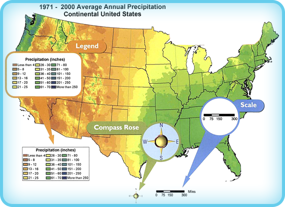
This climate map shows the average annual precipitation in the continental United States. On this map you can see examples
of a legend, a compass rose, and a scale.View Larger Image
|
|
© 2004, Spatial Climate Analysis Service, Oregon State University
|